The Portovenere Regional Nature Park
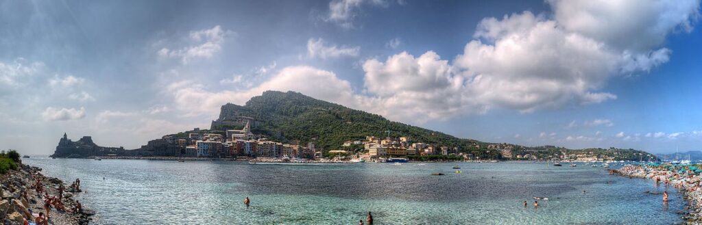
Portovenere is one of the Ligurian Riviera’s gems. Listed among the UNESCO World Heritage Sites in 1997, it is part of the Regional Natural Park that bears the same name together with the islands of the La Spezia archipelago – Palmaria, Tino, and Tinetto – and the territory that stretches to the Albana Valley. The park covers a total of 400 hectares.
Where is Portovenere?
Portovenere rises on the Ligurian coast, as the crow flies 7 km from La Spezia and 10 from Riomaggiore, the easternmost Cinque Terre village. Close to the major sights and attractions of the Riviera Ligure di Levante (eastern Ligurian Riviera), Portovenere is an excellent base for exploring the area. This is especially true if you have a boat, or plan to use the Compagnia di Navigazione del Golfo, the local ferry provider.
Why visit the Portovenere Regional Nature Park
The entire Riviera Ligure di Levante is worth a visit, not only the Cinque Terre. Portovenere and the islands of the Gulf of Poets are a unique haven of nature, wildlife, and culture blessed by sublime lyrical beauty.
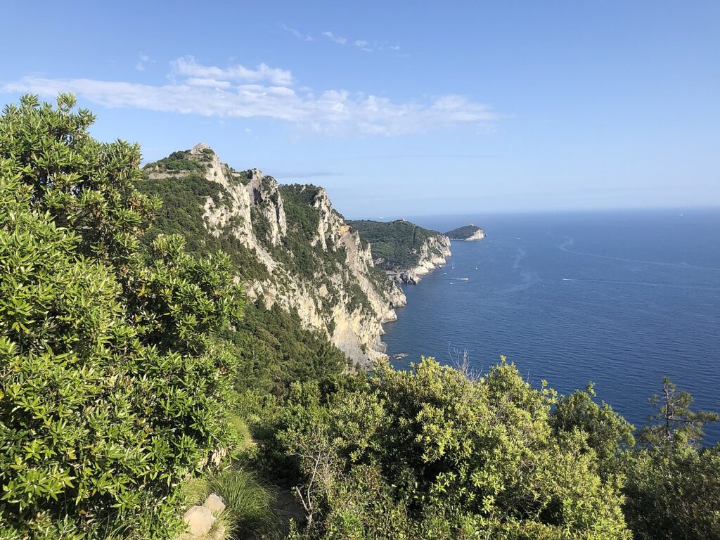
The Porto Venere Regional Nature Park is interesting from a great many points of view: geological, botanical, biological, ornithological, and paleontological.
From a geological point of view, for instance, one will appreciate the colorful rock formations and cliffs, such as Cala Byron, and the “Spiaggia delle Rosse” located in the Albana Valley, between Portovenere and Riomaggiore. The rocks’ unique color is given by the fossil ammonites.
Just beyond, one will admire the cliff where the Muzzerone rock gym rises: climbers from all over the world come here!
From an ornithological point of view, the Portovenere Regional Nature Park is home to rare bird species, such as the imperial crow, the peregrine falcon, the lone sparrow, and the swift.
The islands
The islands of the archipelago constitute a natural extension of the Portovenere promontory and are made up of limestone alternating with portoro, a highly prized black marble with yellow veins that was extracted in the area up to the 1980s.
Palmaria Island
Palmaria, the archipelago’s largest island, boasts lovely hiking trails: walking along these, one can easily visit the whole island in about three hours. Albeit not large, Palmaria comprises extremely beautiful and diverse landscapes. The eastern side features rich, typically Mediterranean vegetation, and slopes gradually down to the sea. The western side, instead, is characterized by high rocky cliffs interspersed with coves and ravines. You’ll find a variety of caves here: the Blue Cave, the Volcanic Cave, and the Cave of Pigeons.
This rocky area is home to numerous colonies of herring gulls: these birds have also gradually settled in the abandoned portoro quarries.
From a botanical point of view, Palmaria houses rare Ligurian species alongside those typical of the Mediterranean maquis. Red cistus, Phoenician juniper, and Porto Venere cornflower, a native plant, are among these.
Palmaria Island is also interesting for its man-made heritage. Used for centuries for military purposes, there are many forts and towers; among these are the Scola Tower, the Umberto I Armored Tower, and Fort Cavour. The latter is connected to the rest of the island by the “path of the condemned”, named after the prisoners who helped build the fort.
Tino Island
Tino Island is a military district, hence off limits for tourists for most of the year. It is open to visitors only on the Feast of St. Venerio, held on September 13 every year.
St. Venerio was a hermit monk who lived on Tino Island at the turn of the sixth and seventh centuries. As the legend goes, on dark nights he used to light a bonfire, to help ships find their way around the Gulf of Poets: this is why, today, he is the patron saint of the Gulf of La Spezia, and the “protector of lighthouses”.
Visitors can see the vestiges of the ancient monastery, and the remnants of fortifications built by the Germans during World War II to defend the port of La Spezia, on the northern coast of the island.
Portovenere’s Madonna Bianca Festival
Approaching Tino Island by boat, you’ll no doubt see the statue of the Madonna Bianca.
The Madonna Bianca has a special meaning for the inhabitants of Portovenere. The image is housed in the church of San Lorenzo, and every August the town holds a special procession dedicated to the Madonna: thousands of candles light up the cliffs around Byron’s Grotto and the church of San Pietro.
Pirates and the timeless charm of the islands of the La Spezia archipelago
These islands’ allure is by no means recent. In the past, this archipelago was preyed on by pirates employed by the powers who wanted to control the area, including France, England, the Republic of Genoa, and the house of Savoy. In the 18th century, Tino became the property of Bacicio do Tin, a pirate who was the Count and owner of the little island until he was captured and hanged. The pirate Bacicio hid his treasure in the sea close to the island, and, as of today, no one has ever found it…
Tinetto
Only a few submerged rocks separate Tinetto, the smallest of the three islands in the archipelago, from Tino.
Tinetto is an islet, rather an island: about half an acre in size, and 17 meters high at its highest point. Not particularly verdant, it is home to a rare subspecies of wall lizard, the “podarcis muralis tinettoi”, and houses the remnants of ancient religious settlements.
The inland
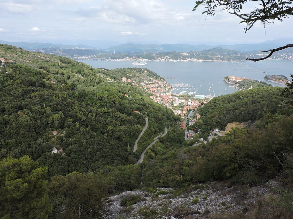
There’s more to the Portovenere Regional Park than the sea, islands, and bays: the inland offers lush vegetation, quaint small villages, mountains, and ruins of ancient castles.
There are several paths you can follow to explore: walking toward Campiglia and Monte della Castellana, for instance, you can admire the fascinating, quintessentially Ligurian, rugged, rocky landscape. Hiking up to the peaks that rise between Riomaggiore and Portovenere is incredibly exciting, and the view that opens up over the rocky ridges is worth the effort.
Campiglia Tramonti
Campiglia Tramonti stands on a ridge overlooking the Gulf of La Spezia. The village is nestled in the folds of the hills, with steep terraces marking the cliff face.
This heavenly spot rises between Portovenere and Monterosso, one of the famous Cinque Terre villages.
From here, one can admire the Gulf of Poets to the south, and the pastel-colored Cinque Terre villages to the north. The seafront is dotted with charming coves, ideal spots to stop for a swim, that offer exceptional views of the rocks that emerge from the water.
In town, you’ll find stores, as well as cafés and restaurants where you can sample one of the area’s most celebrated local products, Sciacchetrà. This special wine is made with grapes grown on the ancient seafront terraces where they capture minerals and brackish air.
The whole area is a hiker’s paradise: trails leading to the nearby villages, mountains, and sea wind along the cliffs and hills.
Monte della Castellana (Castellana Mountain)
Monte della Castellana reaches 512 meters above sea level, dominating the Gulf of La Spezia on one side and the Ligurian Sea on the other. From here, when the skies are clear, you can see the islands of the Tuscan Archipelago, Elba for instance, the Apennines that stretch between Tuscany and Emilia-Romagna, and the Cinque Terre.
There’s an Italian Navy base on the summit, but the area is accessible to those who wish to admire the landscape.
Getting to the Portovenere Regional Nature Park
You can easily reach the park using public transportation. By train, travel to La Spezia and then either take the P line to Portovenere or rent a car. Alternatively, there are ferry boats from La Spezia to Portovenere and Palmaria Island.
See the ferry boat schedule and check availability here.
How long does it take to visit Portovenere and the park?
The Portovenere Regional Nature Park is not huge, but it will take you at least 3 days to explore it all.
The trails
This park is a lovely place for those who love hiking. You can find hiking trails on Palmaria Island and on the hillside that rises above the Church of San Pietro.
You can find details on a few hikes and walks below.
- Portovenere-Muzzerone-Campiglia (trail N. 519, with a possible alternative route)
5.1 km
approximately 2 hours
Reach Portovenere’s main square and take the stairway near the castle walls (you’ll see the C.A.I’s red and white mark). Follow the mule track until you get to an old quarry,
From here, you have two options:
(a) Follow the main trail of the Alta Via delle Cinque Terre, AV5T, and take the path on the right until you get to the paved road that leads up to Forte Muzzerone.
(b) Follow the rocky path, then continue on level ground to the paved road (you’ll be quite close to the summit of Mount Muzzerone – 325 meters above sea level). From here, walk downhill: you’ll reach the main AV5T trail and Sella Derbi. Take the trail that goes uphill along the ridge, and then along the south side of Mount Castellana, and you’ll get to the Campiglia Church (398 meters). Buses to La Spezia leave from here.
- From Fezzano to Muzzerone, or, trail N. 512, also known as the path through the woods, from Fezzano to Ca’ Villano.
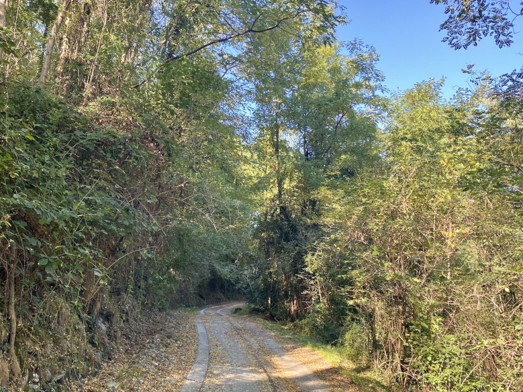
- The 3-kilometer-long path (called Via Mortea or Martina trail) that runs through the woods connecting Le Grazie to Portovenere also offers a pleasant and not too strenuous walk. To return, follow the coast from Portovenere towards La Spezia or take a bus from Portovenere.
- There are two other pleasant trails, N. 516 and 518, that start in Piazza Bastrieri in Portovenere. Each is about 3 km long, estimated walking time is approx. 2 hours. Check the C.A.I website for further information.
- Finally, there’s a 9-kilometer trail that goes from Le Grazie to Sella Derby and the Rifugio Muzzerone and then connects to the “sentiero dell’infinito”. See detailed directions here.
- Looking for a more challenging hike? Walk from Portovenere to Riomaggiore (Cinque Terre) along the wonderful Alta Via delle Cinque Terre! It’s 15 kilometers long and will take you at least 4 hours.
Hiking on Palmaria Island:
Trail N. 510 – tour of Palmaria (medium difficulty): this trail allows you to visit the whole island on foot and enjoy the scenery! The starting point is Terrizzo; the trail is about 6 kilometers long, and during the hike, you’ll be able to see Forte Cavour, Torre Scola, Cala Grande, Caletta, Pozzale, and other points of interest.
The estimated walking time is about 2 hours. Make sure you’re well-equipped and study the route before you go.
The Muzzerone rock gym
Prefer climbing to walking and hiking? Climb the Muzzerone! Countless climbers from all over Europe come to test their ability here and enjoy the view from these incredible cliffs.
The cliffs of the Portovenere Regional Nature provide climbers with a variety of options. The landscape and distinctive local rocks make for a unique experience. Muzzerone dominates the coast that stretches between the Portovenere Archipelago Park and the Cinque Terre National Park, providing breathtaking views.